By the Federal Writers Project, 1939
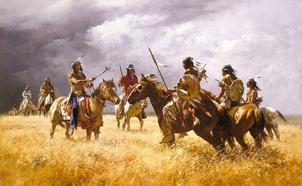
Plains Indians
Before the coming of the Spanish in 1541, the Kansas country was known only to Indian nomadic bands of hunters and warriors and the indigenous tribes of the area. Of the latter, Francisco Vásquez de Coronado mentions three, the Wichita, Kanza, and Pawnee, and vaguely infers that there may have been more.
For a decade, the “Seven Cities of Cíbola” had been in the minds of Spanish conquistadores; to find and plunder these supposed centers of wealth had been the cherished hope of many adventurers. But only Coronado, Governor of New Galicia in New Spain, Mexico, comes into the Quivira quest, which grew out of the disappointing Cibola experience and is the colorful prelude to Kansas history.
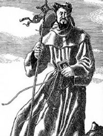
Fray Marcos de Niza
In 1539 Friar Marcos de Niza, whom Coronado had sent on a preliminary search for the Cibola cities, returned with the good news that he had spied one of these wonderful places of “high houses,” though only from a safe distance. An expedition was organized, and 300 Spanish “men of quality” gathered at the rendezvous point at Compostela on the Pacific coast of Lower California in 1540. With Coronado as captain-general, the army started northward, crossed the mountains, and spent the whole of that year in futile marches through Arizona and New Mexico. Winter overtook them at Tiguex, near present-day Bernalillo, New Mexico. By this time, they had found that the cities of Cibola were merely poor pueblo structures. Still, one of Coronado’s captains, Hernando de Alvarado, while on a minor search, had been told by “an Indian slave” whom he called “The Turk,” that far beyond “toward Florida” lay the slave’s own land, Quivira, which was rich in gold and silver. He could guide the white strangers to it.
In April 1541, Coronado and his army left Tiguex, hoping to find in Quivira the precious metals Cibola could not supply. The Turk led them through “the cow country” into western Texas so far Southeastward that the captain-general at a village on the Colorado River called a halt at a village on the Colorado River. Their supplies had fallen dangerously low. For 37 days, they had followed the Turk and, to conserve their grain supplies, lived mainly on buffalo meat. Tiguex was “250 leagues” away, and the unknown country beyond might prove barren. Coronado divided his force. Taking with him only 30 horsemen and six footmen, he headed north to pursue the quest, sending the remainder of his men back to Tiguex to await his return.
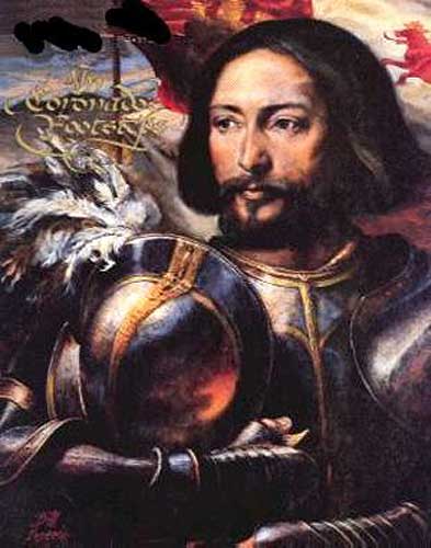
Francisco Coronado
With Coronado went the Turk and another guide. Across the panhandles of Texas and Oklahoma, Coronado proceeded “until he reached Quivira.” His report of October 20, 1541, to his king, reads: “I traveled for forty-two days after I left the force, living all the while solely on the flesh of the bulls and cows which we killed… and going many days without water and cooking the food with cow dung, because there is no other kind of wood in all these plains, away from the gullies and rivers, which are few.” The chronicler Suceso placed Quivira as “in the fortieth degree.” But another authority, mapping the “Province of Quivira,” puts it in the thirty-ninth, between the Arkansas River at Great Bend and the Republican and Kansas Rivers’ confluence at Junction City.
Later Coronado heard that he had tried to incite the Quivira people (Wichita tribe) to kill them. The Turk might have been killed anyway, for, by this time, one fact was obvious to the angry captain-general: Quivira contained no gold or silver. “These provinces,” Coronado wrote, “are a very small affair… there is not any gold, nor any metal at all in that country.” But he found some satisfaction “on seeing the good appearance of the earth… The province of Quivira… 950 leagues from Mexico,” he conceded, “is the best I have seen for producing all the products of Spain, for besides the land itself being very fat and black, and being well watered by the rivulets and springs and rivers, I found prunes like those of Spain, and nuts and very sweet grapes and mulberries.”
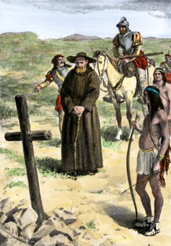
Francisco Juan De Padilla
After 25 days in Quivira, Coronado and his men returned to Tiguex, but by a shorter southwestward route, approximating what later became the Santa Fe Trail. In the summer of 1542, “with less than a hundred men,” he reached Mexico City, where he was shorn of his rank and soon died. But the seemingly fruitless journey introduced the horse to the Plains and established Spanish claim in the entire western region by right of discovery.
A Franciscan monk, Juan de Padilla, who had been with Coronado in Quivira, returned to that country in 1542 but was killed by the Indians. For a half-century, Spanish interest in the far north remained inactive. Then, in 1594, Francisco Levya de Bonilla and Antonio Gutierrez de Humana ventured beyond the Arkansas River, traveling northward for 12 days and reaching another river. On their way back, they were overtaken and murdered. Juan de Onate, in 1601, was the next Spaniard to traverse Quivira. It is probable that more than a century passed before another Spanish party came so far north.
In the late decades of the 17th century, however, the French from Canada began to show an active interest in the land west of the Mississippi River. In 1673 Louis Jolliet, a trader, accompanied by Father Jacques Marquette, descended the Mississippi River from the mouth of the Wisconsin River to below the mouth of the Arkansas River. On the return trip, they left the Mississippi River at the Illinois River. So it hardly seems likely that, as some suppose, Jolliet and Marquette ever reached the Kansas region. Neither did Sieur de La Salle, who, in 1682, descended the Mississippi River from the Illinois River to its mouth, returning along the same rivers. But there is a Marquette map upon which some Kansas authorities seem to recognize certain topographical features descriptive of Kansas. It was probably drawn from information gained by interrogating Indians with whom the priest came in contact. Marquette, in this way, learned much about native peoples he never visited. On his map of the Missouri and Kansas region, he marked the names Ouemessourit (Missouri), Kanza (Kaw), Ouchage (Osage), Paneassa (Pawnee), and some others.
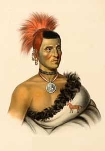
Pawnee Chief Pes-ke-le-cha-co by Charles Bird King, 1841.
In 1694, Canadian traders were among the Osage and Missouri tribes, and during the next few years, the Spanish authorities in New Mexico had several indications that the French traders were on good terms with the Pawnee Indians. By 1706, when Juan de Ulibarri headed a Spanish expedition out of Santa Fe, it was apparent that the French, operating from the north, were becoming rivals of the Spanish of New Mexico for the trade of the interior.
Between 1706 and 1719, the French penetration was steady. In 1708 Canadians explored “three hundred to four hundred leagues” of the Missouri River. During the next decade, the French from the Louisiana capital reached out along other tributaries of the Mississippi River. In 1719 Charles Claude du Tisne, sent up the Missouri River by the Governor of Louisiana, visited the Osage villages near the mouth of the Osage River, and crossed the northeast corner of Kansas to the Pawnee region on the Republican River.
The Spanish heard that “he planted the French flag in native villages and even traded in Spanish horses.” Don Pedro de Villasur, assigned “to drive the French out of the land,” left Santa Fe in 1720 with a Spanish force of 42 soldiers, three settlers, 60 Indians, and a priest. The route was “always to the northeast from Santa Fe.” Possibly the caravan passed through part of Kansas, but the account mentions only three rivers, the Napestle (Arkansas River), the Jesus Maria (south fork of the Platte River), and the San Lorenzo (north fork of the Platte). Villasur and most of the Spaniards were killed in a battle thought to have been fought near North Platte, Nebraska. This defeat ended Spanish operations and left the French in undisputed possession.
The French established themselves more securely in the region in 1722, when Étienne Veniard de Bourgmont erected Fort Orleans near the mouth of the Osage River. Two years later, Bourgmont worked among the Kansas Indians.
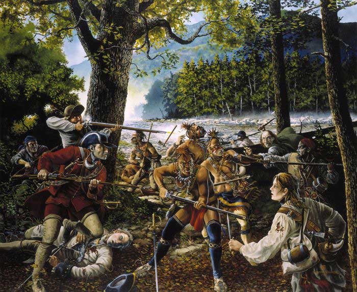
French and Indian War by Jackson Walker.
In 1763 French authority, in all of America came to an end. England, victorious in the long French and Indian War, received the Canadian provinces and all French rights to land east of the Mississippi River. New Orleans and Louisiana, west of the Mississippi River, had already been ceded by France to Spain in 1762.
Spain showed little interest in the Quivira country thus regained, yet the development of Kansas began under its ownership. Pierre Laclede Luguest, with Auguste and Pierre Chouteau of the French fur trading family, established headquarters at St. Louis in 1764 and sent agents from there to the Indians of Missouri, Arkansas, Nebraska, and Kansas. Although few in number, these agents cleared the paths by which Kansas emerged from a little-known region into a definite territory.
In 1801, by the Treaty of Madrid, which confirmed the 1800 Treaty of San Ildefonso, Louisiana west of the Mississippi River was retroceded to France, which by then had renewed its ambitions for a colonial empire and thereby alarmed the recently formed United States. France, under Napoleon, was at the height of its power and too dominant a neighbor to be viewed placidly. Recognition of this and other considerations led President Thomas Jefferson to propose the purchase by the United States of West Florida and New Orleans. Napoleon’s counter-proposal, offering the whole of Louisiana, was accepted. On April 30, 1803, Louisiana, including the Kansas region, became the property of the United States.
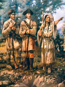
Lewis & Clark with Sacagawea leading by E.S. Paxton, 1912.
Explorations sponsored by the United States began immediately. In January 1803, before the Louisiana Purchase was consummated, President Thomas Jefferson called the attention of Congress to the land west of the Mississippi River, pointing out the possibilities of trade and suggesting an appropriation of $2,500 for the purpose of exploring the country and furthering commerce. The appropriation was made, and an exploring party was organized under the command of Captain Meriwether Lewis and Lieutenant William Clark.
In March 1804, the Territory was divided into two parts. Land south of the thirty-third parallel was named the Territory of Orleans; north of the parallel, including Kansas, became the District of Louisiana, attached for legal purposes to the Territory of Indiana.
On June 26, 1804, Lewis and Clark landed at the mouth of the Kansas River on the first lap of their expedition. By July 4th, they had reached a stream in the present Doniphan County, which they named “Independence Creek” in honor of the day, firing an evening gun and rationing out an additional gill of whiskey by way of celebration. Two years later, on August 5, 1806, they returned to the mouth of the Kansas River with the first reliable information on the climate, topography, and general features of the western country.
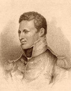
Captain Zebulon Pike
Before the conclusion of the first expedition, a second was organized by the military commandant of Louisiana, General James Wilkinson, and set out from St. Louis on June 24, 1806, under the command of Captain Zebulon M. Pike. He visited the Osage Indians in Missouri and the Pawnee on the Republican River, arriving among the latter on September 25. Here he found a Spanish flag floating over their council tent. The purchase from Napoleon had not fixed the western boundary; the United States claimed territory extending to the Rocky Mountains while Spain fixed the line much farther east. Pike demanded that the Spanish flag be hauled down and the American standard raised in its place, thus putting an end to all Spanish claims east of the Rockies. He turned south to the Arkansas River and followed it to the present site of Pueblo, Colorado, discovering the mountain now known as Pike’s Peak. As this was encroaching on Spanish territory, he was captured and taken to Mexico. During his captivity of some months, Pike gathered considerable information about the possibilities of trade with the Mexican provinces. The accounts of his travels, published in 1810 on his return to the States, directed an avid interest to these provinces.
Of parts of Kansas, he wrote enthusiastically, but he saw no possibilities for white settlement in the arid portions of the Louisiana district. “These vast plains of the western hemisphere,” his account reads, “may become in time as celebrated as the sandy deserts of Africa; for I saw in my route, in various places, tracts of many leagues where the wind had thrown up the sand in all the fanciful forms of the ocean s rolling wave, on which not a speck of vegetable matter existed.”
Maps, presumably based on Pike’s report and showing the desert reaching from the west line of the Missouri and Arkansas Rivers to the Rocky Mountains, from the Platte to the Red River, were incorporated into the school geographies of that period. This misconception gave rise to the legend of a “Great American Desert” that included the whole of Kansas.
Meanwhile, on March 3, 1805, the District of Louisiana was erected into the Territory of Louisiana, independent of the Territory of Indiana and with its own powers of legislation.

Manuel Lisa
Twelve years elapsed before another expedition was attempted, and during that time, a series of events occurred that influenced the future of Kansas. In 1807. Manuel Lisa, a Spanish fur trader, established several trading stations about the headwaters of the Missouri River. The Missouri Fur Company was organized the following year by Lisa, along with Auguste and Pierre Chouteau, and a chain of trading posts was established throughout the western country. This company was dissolved in 1812 and was succeeded by the American Fur Company of the Chouteau’s, who began to concentrate their activities in Kansas.
On June 4, 1812, the Territory of Missouri, with its western boundary approximating that of the present State of Missouri, was created from the Territory of Louisiana, leaving the remainder without law or official identification for a quarter of a century.
The expedition of Major Stephen H. Long, a scientific exploration sent out by the Government, ascended the Missouri River to Council Bluffs, Iowa, in 1819. Long camped there for the winter, then moved south to the Platte and Red Rivers, entered Colorado, where members of his party made the first ascent of Pike’s Peak and returned to the Mississippi River via the Red River. His expedition, following in the path of Pike, accumulated scientific data and introduced the first steamboat to Kansas waters. The Western Engineer entered the mouth of the Kansas River on August 10, 1819, and transported his party up the course for one mile. Here the mud left by flood-waters made it necessary to turn back and continue up the Missouri River.
A period of still deeper significance for the future of Kansas followed. In 1818 the Missouri Territory asked admission to the Union as a slave State; simultaneously, Alabama, also a slave State, asked admission. Alabama was admitted in 1819, balancing the power of the opposing factions in free and in slave States. The debates over Missouri resulted in the Missouri Compromise, passed February 17, 1820, providing that Missouri should be admitted as a slave State but that all future States west of the Mississippi and north of 36 and 30 parallel should be free. On August 10, 1821, Missouri was admitted under the terms of the compromise. The question of slavery shifted to the territory west of the Mississippi River, where it was to flare anew in Kansas. Two years later, the boundary between Missouri and Kansas was definitely fixed.
Thomas Hart Benton, Senator from Missouri, began in Congress his championship of western development in 1824, only to meet with opposition such as the following from Daniel Webster: “What do we want with this vast and worthless area, of this region of savages and wild beasts, of deserts, of shifting sands and whirlwinds, of dust, of cactus and prairie dogs; to what use could we ever hope to put these great deserts, or those endless mountain ranges, impenetrable and covered to their very base with eternal snow? What can we ever hope to do with the western coast, a coast of 3,000 miles, rockbound, cheerless, uninviting, and not a harbor in it? Mr. President, I will never vote one cent from the public treasury to place the Pacific Coast one inch nearer Boston than it is now.”
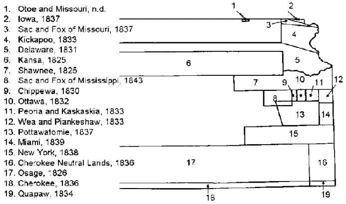
Indian reservations in Kansas, 1846. Source: Barry 1972: 544; Indian Reservations 1846.
The Reverend Isaac McCoy, a missionary to the Indians east of the Mississippi River, journeyed to Washington to propose removing his charges to western reservations beyond the influence of white settlements. His proposal was favorably received, and, in the main, Kansas was selected to provide the reservations, for it was still thought of as a desert country and of no value.
In 1825 the Government arranged treaties with the Osage and Kanza tribes, whereby they gave up their lands in eastern Kansas to make way for the emigrant tribes. The first allotment was granted to the Shawnee; then in rapid succession came the Delaware in 1829; the Kickapoo, Potawatomi, Kaskaskia, Peoria, Wea, and Piankashaw in 1832; the Sac and Fox and the Ioway in 1836; the Miami in 1840; and the Wyandot in 1843. All were crowded onto small reservations in the eastern part of the State.
With them came the missionaries, who had already taught them the rudiments of civilization. Two Presbyterian missions were established in 1820 for the Osage, the Union on the Neosho River and the Harmony on the Marais des Cygnes River. In the spring of 1827, Daniel Morgan Boone, son of Daniel Boone, was sent by the Government to teach farming to the Kansas Indians occupying the southern part of Jefferson County. There he established his family, the first white family in the Territory. His son, Napoleon, born August 22, 1828, was the first white child to be born within the State. In 1829 the Reverend Thomas Johnson introduced Methodism to the Shawnee, establishing a mission near the present town of Turner in Wyandotte County. Four years later, the Reverend Jotham Meeker brought the first printing press to the Shawnee Baptist Mission, and on February 24, 1835, he published the first issue of the Shawnee Sun, the first newspaper in Kansas.
By 1830 trading posts were scattered throughout eastern and central Kansas, reaching from the Platte to the Red River. Within a few years, ferries were strung across the Missouri and Kansas Rivers, roads were cut along the ridges, patches of farmland were cleared and planted, and cabin homes fringed the highways. All this was the work of the Indians, under the direction of missionaries and Government agents.

William Becknell on the Santa Fe Trail.
Captain William Becknell had made the first successful trade journey to Santa Fe in 1821, establishing the route of the Santa Fe Trail. Twelve months later, he led the first wagon train along the trail, beginning the valuable commerce of frontier days. As a midway course between Benton’s proposals for western development and the opposing view, Congress authorized the survey and marking of the Santa Fe Trail in 1825. Fort Leavenworth was established as “Cantonment Leavenworth” in May 1827. Westport (now Kansas City, Missouri) became a depot on the Santa Fe Trail in 1833. Ten years later, the city of Wyandot (Kansas City, Kansas) was begun by the Wyandot Indians.
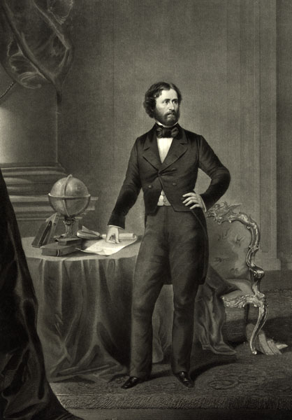
John Charles Fremont by John C. Buttre, 1859.
At this time, the Government decided to send out another exploration under Lieutenant John C. Fremont. He entered Kansas in 1842, completing his outfit at the trading post of Cyprian Chouteau in Wyandotte County on June 10. With Kit Carson as his guide, Fremont explored the Kansas and Platte Rivers and surveyed the South Pass of the Oregon Trail, thereby winning him the title of “Pathfinder.” He followed this exploration with three more, in 1843, 1845, and 1848. Accounts of these expeditions were published immediately by the Government to direct attention to the West, and in this, they were highly successful.
The Mexican-American War ended with the Treaty of Guadalupe-Hidalgo, ratified May 30, 1848. By its terms, the Rio Grande became the boundary between Texas and Mexico. From El Paso to the Pacific, the international boundary westward was established almost as it is now. Northward, the ceded territory reached from a league below San Diego, California, to the Oregon country at 42 north latitude; eastward, it reached the Rocky Mountains. This vast region embraced what was then known as New Mexico and Upper California. What now corresponds to a strip of Texas; the greater parts of New Mexico, Colorado, and Arizona; all of California, Nevada, and Utah; and a little of Wyoming. In addition, the treaty of 1846 with Great Britain had established the right of the United States to the Oregon country. Thus in two years, the United States cleared from its continental path to the Pacific all conflicting sovereignties as far north as the forty-ninth parallel.
This resulted in a tremendous increase in migration over Kansas trails.
Compiled and edited by Kathy Weiser/Legends of Kansas, updated July 2021.
Also See: