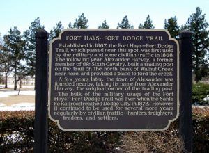
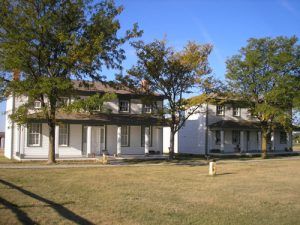
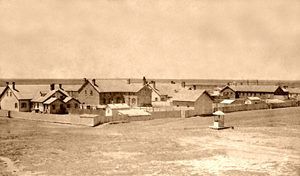
The Fort Hays-fort Dodge Trail, established in 1867, was first used by the military, followed by civilian traffic. It continued to be used regularly until the Atchison, Topeka & Santa Fe Railroad reached Dodge City in 1872.
After the Civil War, the United States turned its attention back to westward expansion, building railroads, and caring for the “Indian problem.” Soon, new cavalry regiments were recruited, western army posts allotted more money, and some of the best military men of the time were assigned to the forts of the Old West.
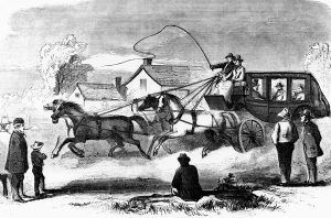
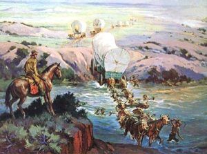
The Fort Hays-Fort Dodge Trail was initially utilized to transfer supplies from the railhead at Fort Hays to Fort Dodge, some 75 miles distant, and an access point for emigrants and traders to the Santa Fe Trail. When the railhead from Fort Harker was moved to Hays, the U.S. Postal Department ordered the Barlow & Sanderson Company to initiate mail deliveries from Hays to Santa Fe, New Mexico, effective November 1, 1867.
The stage line complied with the order and ran from Hays City to Fort Dodge before continuing over the Mountain Route of the Santa Fe Trail to Santa Fe. Stages departed from each end of the line three times each week, with a one-way trip taking about 4 ½ days. The mail continued along this route through the summer of 1868 when the railhead was transferred to Sheridan, and the stage headquarters was relocated to Pond Creek Station.
The road was also busy with a steady stream of military traffic, dramatically increasing during the fall of 1868 as General Philip Sheridan prepared for his winter campaign against the southern tribes.
The approximate 75-mile trail began at Fort Hays and traveled about 4 ½ miles southwest to Five Mile Hollow, so named for its distance from Hays City. It was a ready water supply and grass and soon became a roadside campsite. In November 1871, a wagon train was caught in a snowstorm, and at least one man died, frozen to death while trying to start a fire in the bottom of a wagon.
One mile southwest of Five Mile Hollow, the road intercepted the Smoky Hill Trail, near which was a place called Lookout Station, established by the Butterfield Overland Despatch in 1865. The station was attacked in April 1867 by Sioux and Cheyenne, who burned the building, stole its stock, and nailed the cook to the barn before burning it. The station was rebuilt in 1868. Though the buildings are long gone, a Butterfield Overland Dispatch marker designates the site
The path continued for about four miles before reaching the Smoky Hill River, where the camp of buffalo hunter Billy Dixon once stood. It was built in the fall of 1870 and consisted of a small picket house and a dugout. Urged on by freighters and hunters in the area, Dixon established a small store at the site where travelers could pick up supplies and whiskey. More interested in buffalo hunting, however, Dixon hired a man named Billy Reynolds to run the place. But, Reynolds absconded with all the goods and money in 1871, leaving the building empty and abandoned.
Eight miles distant, the trail came to Big Timbers Creek, which once provided good water and grass for the travelers. A small community called Hampton was settled here, and a post office was established in 1877. The first postmaster was Monty Leach, who established a store. However, the town died when the nearby town of McCracken was organized with the coming of the railroad in 1886. Here, Big Timbers Creek curved, which required two crossings.
The next stop along the trail was at Walnut Creek, about seven miles southwest of Big Timbers. This would become the location of a trading post and, later, the townsite of Alexander. Though this small community continues to exist today, there are no signs of the original trading post other than a historical marker.
The trail then passed through Rush County before clipping the extreme northwest corner of Pawnee County and continuing into Ness County and Ness City. The road continued southwest through Hodgeman County to the Pawnee Fork, the north branch of the Pawnee River. The location was a very bad crossing, often with high waters, and in April 1867, troops under the command of General Hancock built a permanent log bridge across the narrow but steep banked streams.
In December 1869, a trading post was established at Pawnee Fork by John O’Loughlin, who also operated a toll bridge at the crossing. O’Loughlin and James Brannan also constructed several dugouts that provided lodging to soldiers, buffalo hunters, and freighters. Later, the site was sold to George Duncan and became known as Duncan’s Crossing.
Thirteen miles southwest, the trail continued to what was referred to as the middle branch of the Pawnee and named Buckner Creek in honor of Captain Simon Buckner, then stationed at Fort Atkinson. This crossing also had a toll bridge. Here, mail couriers transferred the mail to other couriers headed to Fort Larned before continuing to Fort Dodge.
Another 13 miles distant, the trail came to Sawlog Creek, first identified as the south branch of the Pawnee Fork. The crossing got the name “Sawlog” due to the large amount of timber that lined its banks.
Another 12 miles beyond, earlier travelers finally reached their destination at Fort Dodge.
By 1872, the Santa Fe Railroad reached Dodge City, and the military ceased use of the road. However, it continued to be regularly traveled for several more years by hunters, freighters, traders, and settlers.
Today, several historical markers have been posted along this historic trail, and wagon ruts can still be seen at several locations.
©Kathy Alexander/Legends of Kansas, updated August 2023.
Also See:

